Beneath the bustling streets and coastal plains of General Santos City lies a silent, subterranean network of history that is finally stepping into the light. Between 1942 and 1945, the Japanese Imperial Army meticulously constructed 44 identified bunkers across eight different barangays, turning the city into a fortified defense line against anticipated American invasions. Long hidden by overgrowth and urban expansion, these massive concrete structures are now being resurrected by the local government as premier historical tourism destinations. Under City Ordinance No. 05, these relics have been officially designated as "local city treasures," ensuring that the grit and strategy of World War II remain an accessible lesson for future generations.
The Coastal Watch of Barangay Bula
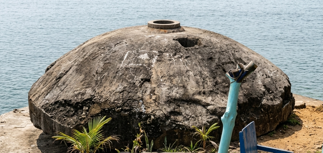
The shoreline of Barangay Bula remains one of the most significant windows into the 1943 defense strategy, housing several well-preserved coastal bunkers. One of the most accessible sites is located in Zone 5, a pillbox-style structure that was originally designed to house gun turrets for repelling naval landings. Visitors are often surprised by the interior’s "Natural Air-Conditioning," as the thick concrete walls maintain a remarkably cool temperature that can comfortably accommodate groups of over 10 people. These bunkers were part of a sophisticated "High-Energy" defensive wall that utilized the natural curve of Sarangani Bay to maximize visibility and protection.
The Mother Camp of Ligaya and San Isidro
Further inland, the landscape of Barangay Ligaya reveals a massive, tunnel-type bunker that historians believe served as the "mother camp" or central command post for Japanese troops. This site contrasts with the smaller defense pillboxes in San Isidro, particularly the Japanese World War 2 Bunker Heritage site along Mabuhay Road, which highlights the city’s role as a tactical stronghold. The sheer variety of the structures—ranging from underground supply tunnels to elevated command posts—showcases a "Strategic Template" of warfare that utilized every inch of GenSan’s topography. By exploring these sites, travelers gain an intimate look at the logistical complexity required to hold such a vital southern gateway.
A Network of Resilience Across the City
The map of these "Local Treasures" extends deep into the heart of the city's other barangays, including Buayan, the site of a former Japanese airbase, and Conel, Baluan, Labangal, and Mabuhay. This extensive network was designed to facilitate the rapid movement of supplies and troops away from the prying eyes of aerial reconnaissance. Today, the 2026 tourism push is focusing on creating a "Heritage Trail" that connects these scattered sites, allowing for an educational journey that spans the entire municipality. As the city continues to modernize, the preservation of these bunkers serves as a vital anchor, ensuring that the legacy of those who witnessed the conflict in the Pacific is never overwritten by progress.
TAGS: